
Waze Power User Guide: Mastering Advanced Navigation and Customization Features to Optimize Your Daily Commute

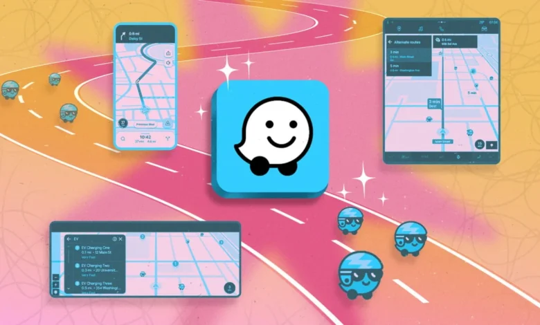
Waze has evolved from a grassroots community project into a sophisticated global navigation ecosystem, serving millions of drivers who rely on its real-time, crowdsourced data to bypass congestion. Since its acquisition by Google in 2013 for approximately $1.1 billion, the platform has maintained its distinct identity by prioritizing community-driven intelligence over the static map data often utilized by competitors. Unlike traditional GPS applications that rely primarily on historical traffic patterns, Waze leverages active user reporting to identify hazards, police presence, and road obstructions within seconds of their occurrence. By understanding the underlying architecture of the app’s settings, users can transition from passive navigation to a highly personalized, efficient driving experience that significantly reduces travel time and stress.
Historical Context and the Evolution of Crowdsourced Navigation
The origin of Waze dates back to 2006, when Israeli entrepreneur Ehud Shabtai founded FreeMap Israel. The project sought to create a free digital map of the country, which evolved into Waze Mobile. The philosophy was simple yet disruptive: instead of relying on expensive, professionally surveyed mapping data, the app utilized the GPS sensors of its users to "map" roads and identify traffic flows. By the time Google acquired the firm, Waze had already established a precedent for dynamic, user-generated content that changed how urban planners and municipal authorities view real-time traffic management. Today, the app functions as a sophisticated data-processing engine, integrating millions of data points daily to provide the most current route optimization possible.
Integrating Calendar Synchronization for Proactive Scheduling
A primary feature for time management is the seamless integration of calendar data, which allows Waze to act as a proactive traffic monitor. By linking a primary calendar, the app monitors the transit time required for scheduled appointments. If traffic conditions deteriorate, the app automatically pushes a "Time to Leave" notification based on current, live traffic reports.
To optimize this, users should ensure their event entries contain precise, geocoded addresses rather than vague descriptions. The synchronization process connects to native iOS or Android calendars, though it remains compatible with third-party platforms like Outlook or Google Calendar. Once synced, users simply select "Plan a drive" within the app. This feature is particularly relevant for professional commuters, as it accounts for "buffer time," effectively turning a passive calendar into an active navigation assistant that reacts to accidents or unexpected construction zones in real-time.
Enhancing Safety with Customized Reminders and Speed Alerts
Safety remains a critical design pillar for Waze. The "Child Reminder" feature is a notable example of the app’s pivot toward practical safety beyond navigation. Originally designed to prevent incidents of children being left in hot vehicles, the feature is fully customizable. Users can input specific text prompts—such as reminders to grab work materials, grocery bags, or essential documents—that trigger upon arrival at a destination.
Complementing this, the "Speedometer" settings provide a vital layer of defensive driving. By accessing the Settings menu and enabling the "Show Speedometer" and "Alert at Threshold" functions, drivers can set a specific percentage or absolute speed limit that triggers a visual and audible warning. This functionality is particularly useful when transitioning between regions with varying speed limit regulations or when traveling on unfamiliar roads where variable speed limits are common. This proactive alerting helps mitigate the risk of unintentional speeding, which accounts for a significant portion of traffic citations globally.
Data-Driven Navigation: Managing Information Density
One of the frequent criticisms of feature-rich navigation apps is the potential for "information overload." Waze addresses this by allowing users to curate the density of their map display. Under the "Alerts and reports" section, users can toggle the visibility of various crowdsourced icons. For drivers who find the map cluttered with reports of minor debris or non-essential hazards, narrowing these settings to show only critical updates—such as police presence, major accidents, or road closures—can improve situational awareness by reducing cognitive load.
For those who prefer the visual interface of Google Maps or Apple Maps but require the real-time hazard data that only the Waze community provides, the app supports background operation. By enabling "Alerts while driving" and running the app in the background, users can receive audio-based hazard notifications while navigating through their preferred primary interface. This dual-app strategy allows for the best of both worlds: high-fidelity map visuals paired with the granular, second-by-second traffic intelligence of the Waze community.
Navigating Tolls, HOV Lanes, and Complex Intersections
Waze offers advanced routing logic tailored to regional infrastructure. Through the "Toll and HOV Passes" settings, users can input their subscription details for express lanes or electronic toll collection systems. This ensures the app calculates routes that leverage these high-speed corridors when it is mathematically advantageous to do so. For those without passes, the app allows for the manual input of passenger counts to ensure compliance with HOV-lane regulations.
Furthermore, the app allows users to mitigate the stress of complex driving environments through the "Avoid difficult intersections" setting. This feature filters out navigation routes that require high-risk maneuvers, such as unprotected left turns across heavy traffic or crossing multiple lanes to reach a turn-off. By prioritizing routes that utilize protected green arrows, roundabouts, or right-hand turns, the app favors safety and ease of navigation over raw speed, a trade-off that is often preferred by commuters navigating unfamiliar urban centers.
Privacy, Customization, and User Experience
Privacy remains a significant concern for users of location-based services. Waze provides a robust suite of privacy controls, allowing users to toggle "Invisible Mode," which hides their presence, profile picture, and username from other drivers. Additionally, users can clear their history of driven routes and saved locations, ensuring that sensitive data is not retained by the application.
The user experience is further enhanced by the app’s integrated audio player, which supports major streaming services like Spotify and YouTube Music. This integration eliminates the need for "app switching," thereby increasing driver focus. Furthermore, the inclusion of custom navigation voices—ranging from pop-culture icons to personal recordings—serves to humanize the interface, making long-haul journeys more engaging.
Analytical Perspective on Future Implications
The implications of Waze’s feature set extend beyond individual convenience; the data harvested by the app serves as a vital tool for city planners. By analyzing aggregate traffic flow data, municipalities are better equipped to synchronize traffic lights, identify infrastructure bottlenecks, and plan for future road expansions. However, the reliance on crowdsourced data also presents a challenge: the accuracy of the system is entirely dependent on the engagement of its user base. As Waze continues to iterate on its features, the balance between providing actionable intelligence and maintaining driver safety will remain the primary metric of its success.
For the average commuter, the key to maximizing the utility of Waze lies in moving beyond the default settings. By customizing alerts, synchronizing calendars, and utilizing the platform’s sophisticated routing logic, drivers can transform their daily commute from a reactive experience into a managed, efficient, and safer process. As navigation technology continues to integrate with broader smart-city infrastructure, the ability to manage these settings will become an essential skill for the modern driver.