
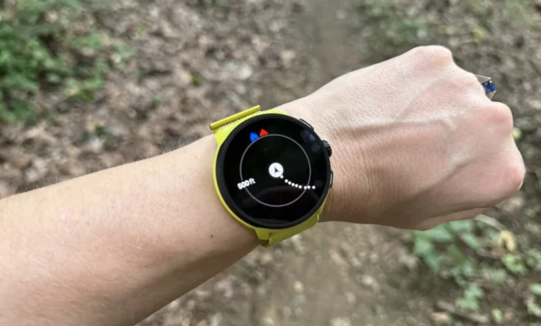
Navigating the great outdoors has undergone a significant technological transformation, moving from handheld paper maps and compasses to sophisticated wrist-worn GPS devices. For years, the integration of high-fidelity offline mapping on a wearable was a hallmark of premium multisport watches, often carrying a four-figure price tag. However, a shift in market strategy and advancements in onboard processing power have democratized this technology, allowing runners, hikers, and endurance athletes to access detailed topography and street-level navigation on mid-range and entry-level devices.
Understanding the hierarchy of navigation features is essential for consumers evaluating these devices. While many fitness trackers advertise "GPS" and "navigation," these terms often refer to vastly different levels of utility.
The Technical Evolution of Wrist-Based Navigation
The current landscape of wearable navigation is divided into three distinct tiers: GPS tracking, breadcrumb navigation, and true offline map support.

GPS tracking is now the industry standard for virtually all fitness wearables. By communicating with global navigation satellite systems (GNSS), these watches record spatial data—longitude, latitude, and altitude—at regular intervals. This data allows users to review their speed, distance, and route geometry post-workout on a smartphone application. However, during the activity, these devices provide only metrics, not visual guidance.
Breadcrumb navigation represents the second tier of utility. This functionality allows the watch to render the user’s path in real-time as a simple line on a blank background. Users can import predefined "courses" or "routes" via third-party apps like Strava or Komoot. While these systems offer a basic sense of direction and can often provide turn-by-turn alerts, they lack context. If a runner encounters a complex intersection or a trail junction, breadcrumb navigation fails to show what lies beyond the path, often leading to confusion in dense environments.
The third and most advanced tier is full offline map support. These devices store topographical data directly on the watch’s internal memory. Instead of a void-like background, the user views a detailed map featuring roads, trails, bodies of water, and geographic contours. This allows for superior situational awareness, enabling athletes to make informed decisions when a trail is blocked or when navigating unfamiliar urban terrain.
A Chronology of Market Shifts
The trajectory of this technology has been rapid. As recently as 2018, mapping was exclusively found in flagship models like the Garmin Fenix series. The hardware requirements for rendering map tiles—specifically higher-resolution screens, faster processors, and increased storage capacity—acted as a barrier to entry.

Between 2020 and 2023, the industry saw a transition. Manufacturers began optimizing their software architectures to handle vector maps more efficiently. The introduction of improved memory management allowed companies like Coros and Suunto to provide mapping capabilities to mid-tier watches through over-the-air (OTA) firmware updates. This shift fundamentally altered the value proposition for the average consumer, who previously had to choose between high-end navigation and budget-friendly pricing.
Market Leaders and Device Analysis
The current market offers a range of options, from high-performance training tools to budget-conscious entry points.
The Garmin Forerunner 970 ($750) remains the industry benchmark for high-end performance. Its mapping suite is arguably the most polished, offering comprehensive routing, live heatmaps, and detailed topographical layers. For power users, the integration with Garmin’s ecosystem—including advanced training metrics and the inclusion of a built-in flashlight—justifies the premium cost. It remains the standard for long-distance trail runners and ultra-marathoners.
In the mid-range segment, the Suunto Run 2 ($399) and Race 2 ($499) have gained traction by focusing on clarity. Suunto’s implementation of breadcrumb-enhanced mapping provides highly legible directional arrows, which are often preferred by athletes who require immediate, glanceable data while moving at high speeds.

Perhaps the most disruptive entry is the Coros Pace 4 ($249). The recent decision by Coros to enable offline mapping on the Pace 4 via a software update serves as a case study in modern product lifecycle management. By extending the utility of existing hardware, the brand has effectively challenged the notion that high-end navigation must be tethered to high-end pricing. While internal storage limitations prevent users from loading continental-scale maps, the ability to store local regions makes it a viable tool for daily training and local trail exploration.
At the budget end of the spectrum, the Amazfit Active Max ($170) provides a pragmatic alternative. By prioritizing a large, high-resolution screen, the device allows for easy map interaction. However, analysis of the user experience reveals the trade-offs: while the hardware is capable, the software interface—often described as less fluid than its competitors—can present a steeper learning curve. The device is best suited for casual users who require basic mapping for urban or well-marked trail navigation.
Strategic Implications for Consumers
The decision to include mapping functionality on entry-level devices is not merely a feature addition; it is a strategic shift in how hardware manufacturers compete for market share. As fitness data becomes more commoditized, brands are increasingly looking to "value-add" features to differentiate themselves.
Industry analysts note that this trend will likely continue. As screen technology continues to improve and power efficiency becomes the priority for silicon manufacturers, the "map-less" watch may soon become a relic of the past, similar to the transition from heart rate monitors to GPS-enabled watches in the early 2010s.

For the consumer, the implications are twofold. First, the barrier to safe navigation has been lowered. Runners and hikers can now access professional-grade orientation tools for a fraction of the cost previously required. Second, consumers must now carefully evaluate storage specifications. Because offline maps require significant internal memory, the ability to store music or other media on a watch is often inversely proportional to the amount of map data a user can carry.
Looking Ahead: The Future of Wearable Navigation
Looking forward, the integration of AI-driven route optimization and real-time topographical updates via cellular connectivity remains the next frontier. While currently limited by battery constraints, the evolution of low-power wide-area networks (LPWAN) could eventually allow these watches to download real-time weather and trail condition data, further increasing safety for outdoor enthusiasts.
For now, the current generation of watches demonstrates that the "premium" label is becoming increasingly fluid. Whether one chooses the robust, feature-dense ecosystem of a top-tier Garmin or the lean, software-forward approach of a budget-friendly Amazfit, the fundamental utility of the wrist-worn map has firmly established itself as a necessary component of modern athletic gear. As competition intensifies, the primary beneficiaries remain the users, who are finding that the map of the world is now significantly more accessible from their own wrists.