Google-Backed FireSat Satellites Launch into Orbit, Marking a New Era in Wildfire Detection as Global Blazes Intensify

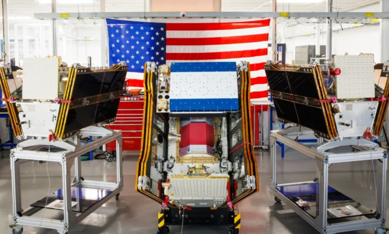
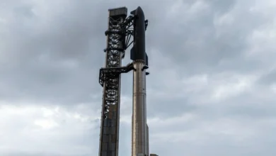
The first three operational satellites in the Google-backed FireSat program successfully launched into orbit on July 7, 2026, heralding a significant advancement in global wildfire detection capabilities. Carried aboard a SpaceX Falcon 9 rocket from Vandenberg Space Force Base in California, this deployment represents a critical transition to "initial operational capability" for the FireSat constellation, managed by the nonprofit Earth Fire Alliance. These microsatellites are designed to provide unparalleled early detection of wildfires, including small blazes often missed by existing systems, and are slated to begin actively supplying data to fire agencies in the United States, Australia, and Europe before the year’s end, amidst an escalating global wildfire crisis that has seen devastating infernos spread across continents.
A New Era in Wildfire Detection
The FireSat program distinguishes itself as the first satellite constellation specifically engineered for wildfire detection. Unlike conventional Earth observation satellites, which may offer broader environmental monitoring but lack the dedicated focus and resolution for nascent fires, FireSat employs advanced multispectral imaging technology. This allows the satellites to penetrate thick smoke and cloud cover, identifying heat signatures from fires as small as five by five meters (approximately 16 by 16 feet). This precision is crucial for early intervention, enabling firefighters to tackle blazes before they escalate into uncontrollable conflagrations.
The efficacy of this cutting-edge technology was first demonstrated by a FireSat Protoflight satellite, launched in March 2025. Over its operational period, this prototype collected more than one million images, proving its ability to detect low-intensity blazes that remained invisible to existing satellite networks. This successful validation paved the way for the deployment of the first operational satellites, affirming the program’s potential to revolutionize wildfire management globally.
Strategic Partnerships and Financial Commitments
The ambitious FireSat initiative is the result of a collaborative effort involving significant financial and technological backing from leading entities. California-based satellite manufacturer Muon Space designed and built the specialized satellites, bringing their expertise in small satellite technology to the forefront. The project has garnered substantial financial support, with Google committing over $15 million towards its initial deployment, underscoring the tech giant’s investment in climate resilience solutions. Further demonstrating broad philanthropic interest, the Bezos Earth Fund pledged an additional $26 million, highlighting the widespread recognition of the urgent need for enhanced wildfire detection.

The Earth Fire Alliance, a nonprofit organization, is tasked with managing the FireSat constellation and facilitating the distribution of its critical data to fire agencies worldwide. This operational model ensures that the data, vital for rapid response, is accessible to those on the front lines of wildfire suppression, embodying a commitment to global public safety and environmental protection.
Phased Deployment and Future Vision
Following a three-month testing period, the initial trio of FireSat satellites will commence active data provision, covering every fire-prone region on Earth at least twice daily. This initial coverage marks a significant improvement over previous capabilities, offering a more consistent and timely overview of potential fire threats.
The program’s "early adopter" organizations, which will begin utilizing FireSat data this year, include key fire agencies in California, Colorado, Australia, and Portugal—regions consistently battling severe wildfire seasons. This strategic rollout targets areas most impacted by increasing fire activity, providing immediate, tangible benefits to communities and ecosystems under threat.
The long-term vision for the FireSat constellation is even more ambitious. As more satellites are launched in subsequent phases, the program aims to provide hourly imagery anywhere in the world by 2029. This frequent revisit rate would dramatically reduce the window of opportunity for small fires to grow, offering unprecedented situational awareness. The ultimate goal, projected for the early 2030s, is to deploy a full constellation of more than 50 satellites, enabling imagery updates every 20 minutes. Such a comprehensive network would provide near real-time intelligence, fundamentally transforming how wildfires are detected, monitored, and combated.
The Earth Fire Alliance projects that even an hourly revisit rate by the FireSat constellation could lead to substantial benefits, including saving over $1 billion in fire damage costs, preventing nearly 22 million tons of carbon emissions, and protecting 3,500 homes and 1.3 million acres of land. These projections underscore the immense potential for FireSat to mitigate the devastating human, economic, and environmental impacts of wildfires.

The Global Wildfire Crisis: A Pressing Need
The launch of FireSat comes at a critical juncture, as the world grapples with increasingly severe and widespread wildfires, exacerbated by climate change. The summer of 2026 has witnessed an alarming surge in blazes, particularly across Canada, where hundreds of wildfires have generated vast plumes of smoke that have spread across North America. This smoke has inflicted hazardous air pollution upon more than 100 million people in Canadian and U.S. cities, forcing thousands in First Nations communities to evacuate their homes.
Experts, including Werner Kurz, a retired senior research scientist at Natural Resources Canada, have long predicted this intensification. "What is unfolding is what climate and forest scientists have been predicting for 30 years," Kurz stated in an interview with The Atlantic. "That as the world gets hotter and drier, we are exposing forests to more and more risk, and the old strategies of fire suppression are simply being overwhelmed." Indeed, Canada has experienced two of its most destructive wildfire seasons in 2023 and 2025, with the last three fire seasons ranking among the ten worst on record. As of July 17, 2026, the Canadian Wildland Fire Information System reported nearly 900 active wildfires, with over 3,600 blazes burning more than 6.6 million acres year-to-date. Dozens of these fires are currently deemed "out of control," necessitating a strategy of monitoring rather than active suppression due to limited resources and the inherent risks to firefighting personnel.
Leveraging AI for Predictive Power
Google’s involvement extends beyond financial support; Google Research plans to integrate the company’s advanced AI models with the operational FireSat data. This synergy aims to accurately identify very small fires by comparing real-time satellite imagery with historical data, and crucially, to inform predictive modeling of wildfires. Such AI-driven insights could forecast fire behavior, trajectories, and potential spread, enabling more strategic deployment of firefighting resources and timely evacuation orders. Google celebrated the launch of the first operational FireSat satellites as "another tangible step forward in putting practical AI to work for climate resilience," highlighting the transformative potential of artificial intelligence in environmental management.
The Unseen Carbon Cost of AI Infrastructure
However, the rapid expansion of AI capabilities, while offering solutions to climate challenges, also presents its own environmental paradox. The development and deployment of sophisticated AI models require massive computational power, primarily housed in large data centers. These data centers consume prodigious amounts of electricity, often met by new natural gas projects in the United States. Projections indicate that the greenhouse gas emissions from this burgeoning data center boom could collectively exceed 129 million tons per year, a figure comparable to the emissions of entire nations.
Google itself has acknowledged the formidable challenge of sourcing enough clean energy to offset the escalating electricity demands of its data centers. In 2025 alone, Google’s company-wide electricity usage surged by 37 percent, largely driven by its AI buildout. This raises critical questions about the net environmental impact of AI-powered climate solutions, urging a holistic assessment of their entire lifecycle, from energy consumption to operational benefits. While FireSat’s early detection capabilities promise significant reductions in carbon emissions from wildfires, the carbon footprint of the underlying AI infrastructure cannot be overlooked.

Beyond Detection: A Holistic Approach
While enhanced detection is a vital component of wildfire management, it is merely one piece of a complex puzzle. As experts and fire agencies attest, preventing blazes from spiraling out of control requires a multi-faceted approach. This includes proactive ecosystem management through prescribed burns, which reduce fuel loads and promote forest health, and robust firefighting resources capable of active suppression when unwanted fires ignite.
The traditional model of fire suppression has proven increasingly inadequate in the face of megafires fueled by climate change. The sheer scale and intensity of recent wildfires, such as those in Canada’s boreal forests, frequently overwhelm available resources. Individual Canadian provinces typically bear the primary burden of acquiring and contracting for essential firefighting aircraft, such as fixed-wing air tankers and heavy-lift helicopters. In recent years, every available aircraft has often been pressed into service, highlighting a systemic strain. Recognizing this critical gap, the Canadian government in May 2026 leased 10 new aerial firefighting aircraft to serve as surge assets for provinces, a move reflecting the urgent need for greater national capacity.
Voices from the Front Lines and Future Outlook
Officials from early adopter fire agencies have expressed cautious optimism about FireSat. A spokesperson for the California Department of Forestry and Fire Protection (CAL FIRE), while not providing a direct quote for this article, noted in a recent briefing that "any tool that offers earlier detection and more precise location data is invaluable in our fight. It allows us to allocate our limited resources more effectively and potentially save lives and property by getting ahead of fires before they become unstoppable." Similarly, the Earth Fire Alliance’s leadership has emphasized the collaborative nature of the program, stating that "FireSat is not just about satellites; it’s about empowering communities and firefighters with the information they need to protect our planet."
The implications of FireSat’s success extend beyond immediate fire suppression. Improved data can inform long-term land management strategies, support climate adaptation efforts, and potentially reduce the health burden associated with smoke exposure. However, the broader challenge of climate change, which intensifies wildfire risks, remains paramount. FireSat, while a powerful new weapon in the arsenal against wildfires, must be seen as part of a larger, integrated strategy that includes global efforts to reduce greenhouse gas emissions, invest in sustainable forest management, and strengthen community resilience. The future success of FireSat will not only be measured by the fires it detects but also by how effectively its data is integrated into a comprehensive, globally coordinated response to the climate crisis.